Why Adelaide Looks Different: Parklands, City Planning and a Culture Built Around Markets
Adelaide city planning is unusually easy to recognise on a map. A grid of streets sits inside a broad band of green, with squares interrupting the built centre and another part of the city across the river. William Light drew the central layout in 1837. Later traders, residents and public bodies changed how people used the spaces within it.
Produce sellers shifted the focus of food shopping. Migrant families brought businesses and cooking traditions into the market district. A shopping street became a pedestrian mall, while a central square acquired national significance as a place of Aboriginal political expression. These changes help explain why Adelaide's plan remains visible without making the city feel like a completed nineteenth century project.
Trippy Tour Guide's paid Adelaide City Highlights walking tour offers local audio stories for exploring the centre. Understanding the relationship between its planned spaces and the activities that fill them gives a visit more depth, whether you are looking across a square or deciding what to try at a market stall.
Kaurna names place the city within an older landscape
Adelaide occupies Kaurna Country. The city's own history identifies Tarntanya as a name associated with the place before European settlement, and Kaurna names now accompany parks and significant sites across the centre. Seeing these names on signs is an invitation to understand a geography that was not created by the colonial grid.
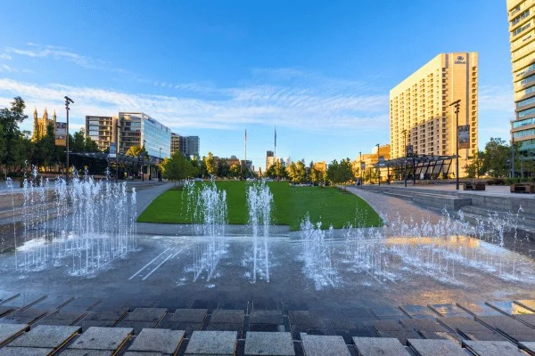
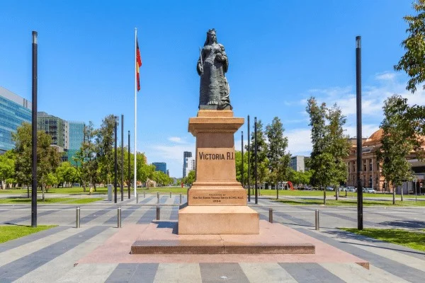
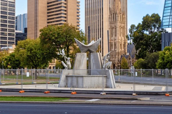
Victoria Square/Tarntanyangga makes the relationship especially clear. It occupies a central position in the planned city and has continuing significance for Aboriginal gathering and political activity. In July 1971, the Australian Aboriginal Flag was first raised here. Its presence connects a space often photographed for fountains and civic buildings to a national history of rights and representation.
The dual name records two histories. One name belongs to the colonial system of commemoration; the other acknowledges a Kaurna relationship with place. When visiting, give the local interpretation time and look at how the square is used today. Political gatherings and ordinary meetings continue to add meaning to a space that a map represents as a simple open shape.
Victoria Square/Tarntanyangga remains a place of public gathering within central Adelaide.
Adelaide city planning and William Light’s 1837 layout
William Light's 1837 plan established the central arrangement of Adelaide, including broad streets, town squares and surrounding Park Lands. The River Torrens separated the principal city areas. The national heritage listing recognises the survival of this layout as a major part of Adelaide's significance. Light included the green spaces in the original organising idea.
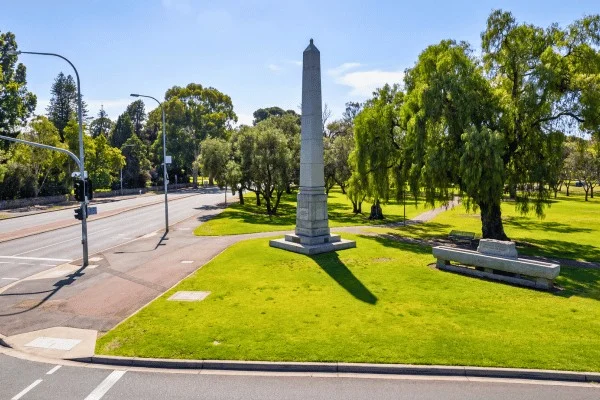
The distinction is visible even before you enter a park. Streets have edges, and the transition towards the Park Lands makes the boundary of the central city unusually legible. Squares create smaller pauses within the grid. Together, those spaces offer different scales of openness: a place to stop during a city day and a wider landscape around the built centre.
The plan also needs to be understood as a colonial undertaking. Surveying divided land into units that could be allocated and developed under a new system. Admiring the clarity of the drawing should not obscure the Kaurna history of the land being surveyed. The lasting achievement of the layout and the consequences of colonisation belong to the same historical setting, even though they are often presented in separate accounts.
For a visitor, compare a current map with what you experience at street level. The plan can suggest order, but shade, traffic and the distance between crossings determine how comfortable a particular stretch feels.
The Adelaide Park Lands were never an untouched green ring
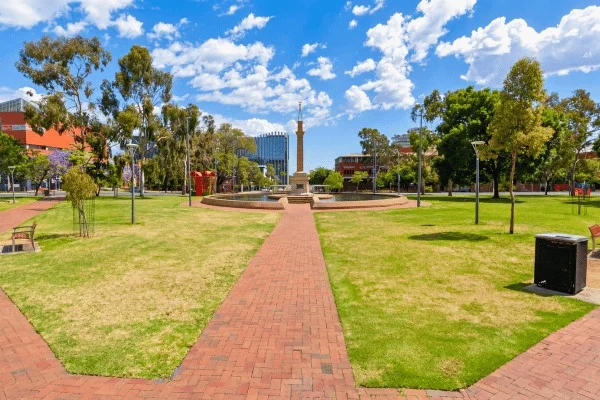
The familiar description of a green belt can hide a complicated working history. The South Australian heritage assessment records early activities including brick making, lime burning and grazing. The Park Lands also accommodated a cemetery and other uses that answered immediate colonial needs. People argued over who could occupy these spaces and how they should be used.
The earlier uses help explain the present mix of recreation areas and institutional settings. A park's appearance may result from repeated decisions about paths, planting and facilities. Each area has its own development history, so the present landscaping cannot be read directly from Light's original drawing. Conservation has to work with those accumulated changes.
The National Heritage area also has defined limits. The federal account distinguishes the listed layout and open spaces from privately owned land and certain railway and government areas. The heritage designation should not be taken to mean that every building within the central city belongs to the same protected area.
On the ground, the variety is part of the interest. A space used for sport has different needs from a formal garden or a quiet memorial setting. Leave room to notice those uses, especially where an open area connects a residential neighbourhood to the centre. The Park Lands serve residents throughout the year as well as visitors passing through.
The Central Market grew from the practical needs of traders
The Central Market began in 1869 when produce traders moved from the city's eastern market area to a new site on Grote Street. The official opening followed in January 1870, under the name City Market. Early trade included food as well as hay, reflecting the needs of a city whose transport and supply systems were very different from today's.
The market's built form developed gradually. Work on the surviving facade began in 1900, and electric lighting replaced gas in 1902. Fire later forced further change, including major damage to the southern stall area in 1977 and refurbishment completed in 1983. The institution's continuity therefore rests on rebuilding and adaptation as much as on the survival of old fabric.
A market is particularly good at showing the relationship between Adelaide and its surrounding producers. What arrives in quantity, how it is displayed and what shoppers ask for all reveal a working food economy. You can begin with a simple question about an ingredient you do not usually cook with. A trader's suggested preparation may explain its place in local kitchens more clearly than a list of regional specialties.
The paid Adelaide City Highlights audio walking tour provides city stories around a market visit. Keep the market's own current trading information handy when planning the day, since the range of stalls open can vary with the day and time.
Migrant businesses gave the market district much of its character
Lucia Rosella's business provides one specific entry into the market's food history. Lucia's Pizza and Spaghetti Bar opened in 1957. Family accounts describe a business that expanded from serving Italian food into selling ingredients and prepared products that customers wanted to take home. Customers could order a meal and then buy ingredients to try similar cooking at home.
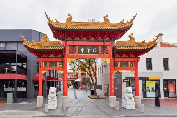
The nearby Chinatown district adds another set of histories. Its gateways are prominent markers, but they should not be mistaken for the starting date of Chinese life in Adelaide. South Australia's thematic heritage study records the district's redevelopment and the construction of a northern gateway in 1990. The visible streetscape is a relatively recent expression of longer patterns of migration and commercial activity.
The district's current food businesses represent several Asian cuisines. Treat that variety as something to learn about specifically. Chinese, Vietnamese and Malaysian cooking are not interchangeable labels for a single market atmosphere. Menu descriptions, ingredients and conversations with traders can help you understand a particular dish without making assumptions about the person selling it.
A useful market visit can be modest in scale. Choose a few things with enough time to enjoy them. These are workplaces with regular customers, and the pace of service is part of their daily rhythm.
Civic buildings show the ambition within the orderly street plan
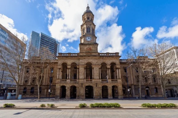
Adelaide Town Hall was completed in 1866. Its scale and ornament gave municipal government a substantial presence within a relatively young colonial city. Edmund Wright was involved in its design, and his career connected architecture with civic life: he also served as mayor. The building is therefore associated with people who were shaping both the physical city and its institutions.
The tower helps establish the building as a point of reference, while the street frontage places it within the commercial centre. Look at how the principal entrance is distinguished from the repeated windows around it. The design has to present a recognisable public address while accommodating rooms with different uses behind the facade.
Civic architecture also benefits from the public spaces around it. A square or broad street allows a building to be seen as a whole, but it also supplies a place where people can gather outside official interiors. That relationship helps explain why Adelaide's planning history cannot be separated entirely from its history of public life. A city hall matters through the business conducted within it and through the events that bring people towards it.
The continuing use of a historic hall requires maintenance and adaptation. Check the venue's own information for public events and which rooms visitors can enter.
Rundle Mall changed how a central street was used
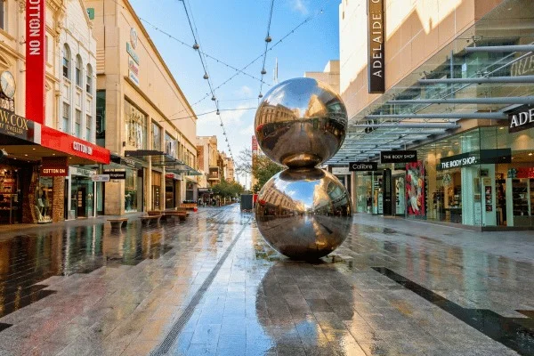
Rundle Mall officially opened on 1 September 1976. Converting the western part of Rundle Street into a pedestrian shopping area changed the relationship between shops and the space outside them. People could cross and gather within an area previously organised around a street carrying traffic. The street remained a commercial place, but the conditions of shopping changed.
Bert Flugelman's The Spheres arrived in 1977. The two stainless steel forms, commonly called the Mall's Balls, became both public art and a meeting point. Their reflective surfaces stretch the surrounding streetscape and the people standing nearby. The city records that the sculpture was donated by the Hindmarsh Building Society for its centenary.
The work gives the pedestrian space something that a conventional traffic corridor would struggle to accommodate: an object around which people can stop without needing to make a purchase. Its popular nickname also shows how residents can give a commissioned artwork a life beyond its formal title. Familiarity grows through repeated meetings and ordinary use.
Compare the mall with a nearby street that still carries vehicles. The difference is audible as well as visible. The width of the paved space may be similar, but the opportunities to stand, look at a shopfront or meet someone are organised differently. Adelaide's original grid provided the framework for this later change.
The plan becomes meaningful through the way people use it
Adelaide's distinctive form is easiest to appreciate when you connect the overview with individual places. The Park Lands provide shade around the centre, while the market brings regional produce into daily shopping. In Victoria Square/Tarntanyangga, the first raising of the Aboriginal Flag gives a familiar gathering place a specific national history.
These experiences need different amounts of time. The map can be understood quickly, while a market rewards a slower visit and a historic building may depend on opening arrangements. Plan around a few interests and leave time for them. The orderliness of the streets can make distances look deceptively simple, especially when you include time spent inside venues or waiting to cross major roads.
Trippy Tour Guide's paid Adelaide City Highlights walking tour adds local context while you explore. Keep looking at the relationship between the planned spaces and the people using them. That is where the city's nineteenth century layout meets the food businesses, public art and civic conversations that keep changing Adelaide today.
Frequently asked questions
Who designed Adelaide?
William Light's 1837 plan established the central arrangement of streets, squares and surrounding Park Lands. Important elements of that layout survive and are recognised through national heritage listing.
Were the Park Lands always used only for recreation?
No. Their history includes grazing, industrial activities and other colonial uses. The present landscapes developed through later decisions about planting, facilities and public access.
When did Adelaide Central Market begin?
Traders established the market on its present site in 1869, and the official opening followed in January 1870. It was originally called the City Market.
Why does Victoria Square also have the name Tarntanyangga?
The dual name acknowledges the place's Kaurna significance alongside its colonial name. The square also has a continuing history of Aboriginal gathering and political expression.
Why does Adelaide have Park Lands around its centre?
William Light included surrounding Park Lands in his 1837 plan, alongside broad streets and town squares. They formed part of the city’s structure from the outset. Their later uses were varied, including grazing and industrial activities, so today’s landscaped spaces should not be mistaken for an untouched green ring preserved exactly as it was first drawn.