How the Brisbane River Shaped the City: Settlement, Floods and a Changing Waterfront
Brisbane River history runs through the city’s trade, bridges and flood memories. Its bends explain why places that look close on a map can face one another across water, why bridges have changed daily journeys, and why an attractive waterfront can also carry difficult memories. The river made trade possible, but its floods repeatedly damaged the buildings and transport links along its banks.
The modern view can conceal that history. Restaurants occupy places once used for handling freight. A park can stand on ground that supported a very different neighbourhood. A calm reach of water gives little indication of the forces recorded in photographs of the city's floods. Understanding those changes makes the waterfront worth more than a passing glance from a bridge.
The paid Brisbane highlights walking tour from Trippy Tour Guide provides local audio stories for a city visit. To understand the larger setting, start with the river's role in bringing people together and separating the places where they lived.
A river with a history before Brisbane Town
The river and its surrounding Country supported Aboriginal communities long before colonial officials chose a site for Brisbane Town. Turrbal and Jagera histories belong to the city and the wider region. Queensland's heritage studies record the riverbanks as places of food gathering, movement and social life, rather than empty land awaiting settlement.
The name Meeanjin appears in accounts of the place selected for the colonial settlement. The National Museum of Australia identifies it as the local Turrbal name used for that location. Place names matter because they preserve a way of understanding the land that does not begin with a surveyor's street plan. They also remind visitors that the history of a city can be much older than the institutions that give it an official foundation date.
When reading riverside interpretation, pay attention to whose account it presents. A colonial diary can record that an encounter happened while giving only one participant's understanding of it. Local Indigenous interpretation can explain meanings that such records omit. Holding those different kinds of evidence apart produces a more careful history than turning every early encounter into a simple story of welcome or conflict.
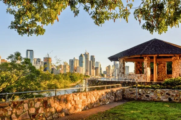
Green space and the river divide the foreground from Brisbane's towers.
The penal settlement depended on supplies arriving by water
The British penal settlement first established at Redcliffe in 1824 moved to the Brisbane River in 1825. The National Museum notes that the precise date and reasoning behind the choice of the town site are not securely documented. Commandant Henry Miller and pilot John Gray selected a location upriver from Breakfast Creek.
The Commissariat Store shows how the settlement functioned after the decision. Convict labour built its original stone structure in 1828 and 1829. The store managed provisions for the military, convicts and colonists, with duties extending into other supplies and administration. Its position near the river reflected the need to receive, hold and distribute goods.
A storehouse can seem less dramatic than a prison, yet it explains the daily operation of a penal colony. Control over food and equipment affected everyone in the settlement. The labour that built the walls was itself part of that coercive system. Looking at the building as a supply depot, and asking who worked there under what conditions, gives its heavy masonry a more specific meaning than simply calling it old.
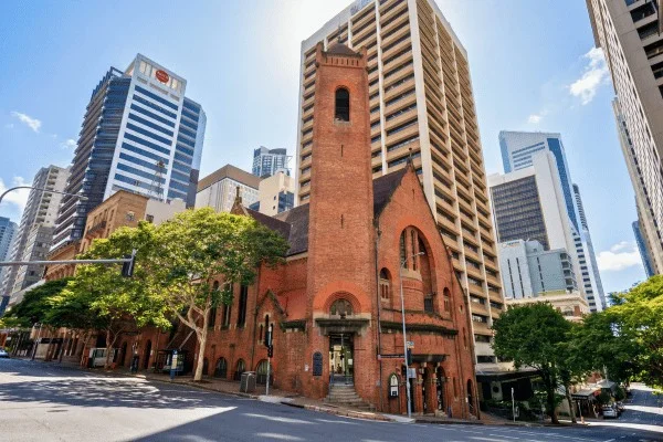
Wool stores made the river part of a regional economy
The river's commercial role extended far beyond the central settlement. In Newstead and Teneriffe, wharves and railway sidings attracted industry. Brisbane City Council's heritage account describes wool arriving by rail, being displayed and stored, then pressed into bales and moved to wharves for export. The buildings were part of a chain linking inland production to overseas markets.
This helps explain the scale of the surviving wool stores. Their broad floors and large windows answered the needs of handling and inspecting a commodity. A warehouse facade is therefore evidence of work, even after apartments or hospitality businesses move inside. Its form was not originally designed to provide the kind of residential character that later buyers might find attractive.
The council also records workers' cottages near the industrial areas and larger homes on higher ground. The river economy shaped residential geography as well as employment. For visitors, the useful comparison is between the spaces where goods moved and the places where people lived. Both belong to the same commercial history, though one may have survived more visibly than the other.
Conversion creates its own layer of history. The former Queensland Primary Producers store, for example, became apartments in the mid 1990s. That change retained a substantial building while ending its original industrial use. When looking at a converted store, distinguish the surviving outer walls from later entrances, balconies and internal arrangements. An old exterior can contain a thoroughly modern pattern of occupation, and both dates belong in an account of the building.
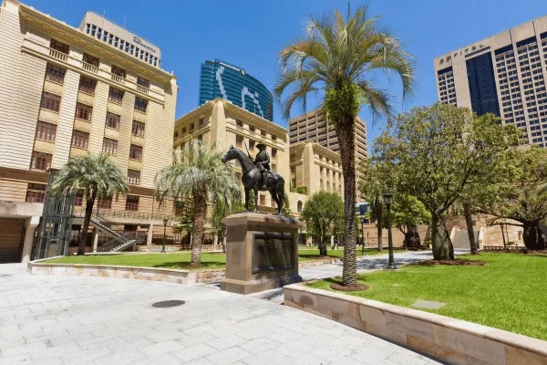
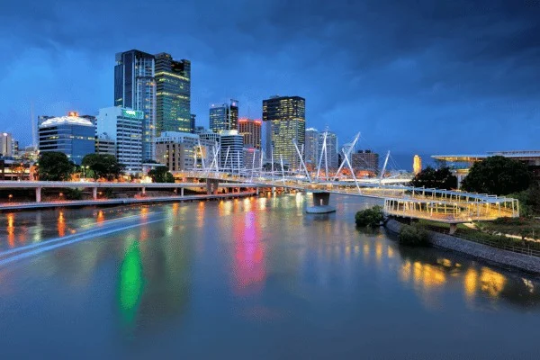
Brisbane bridges changed the practical size of the city
A bridge can turn a difficult commute into an ordinary journey. Workplaces across the water become easier to reach, and neighbourhoods gain a more direct connection. Queensland State Archives records public demands for a crossing at Kangaroo Point long before the Story Bridge was built. By the 1920s, pressure on existing crossings had become a matter for formal investigation.
Construction of the Story Bridge began in 1935, during the Great Depression, and it opened on 6 July 1940. The project formed part of the state government's response to that economic crisis. Its steelwork required skilled labour and difficult foundation work, with deaths during construction recorded in the city's heritage account. The finished structure should be read with those working conditions in mind.
From a distance, its repeated steel shapes look orderly and almost effortless. Historical construction images reveal a slower process of separate elements being assembled over water. The paid Brisbane highlights audio walking tour adds city stories to a visit, while a closer look at the bridges can show how engineering decisions changed the ways residents used the river.
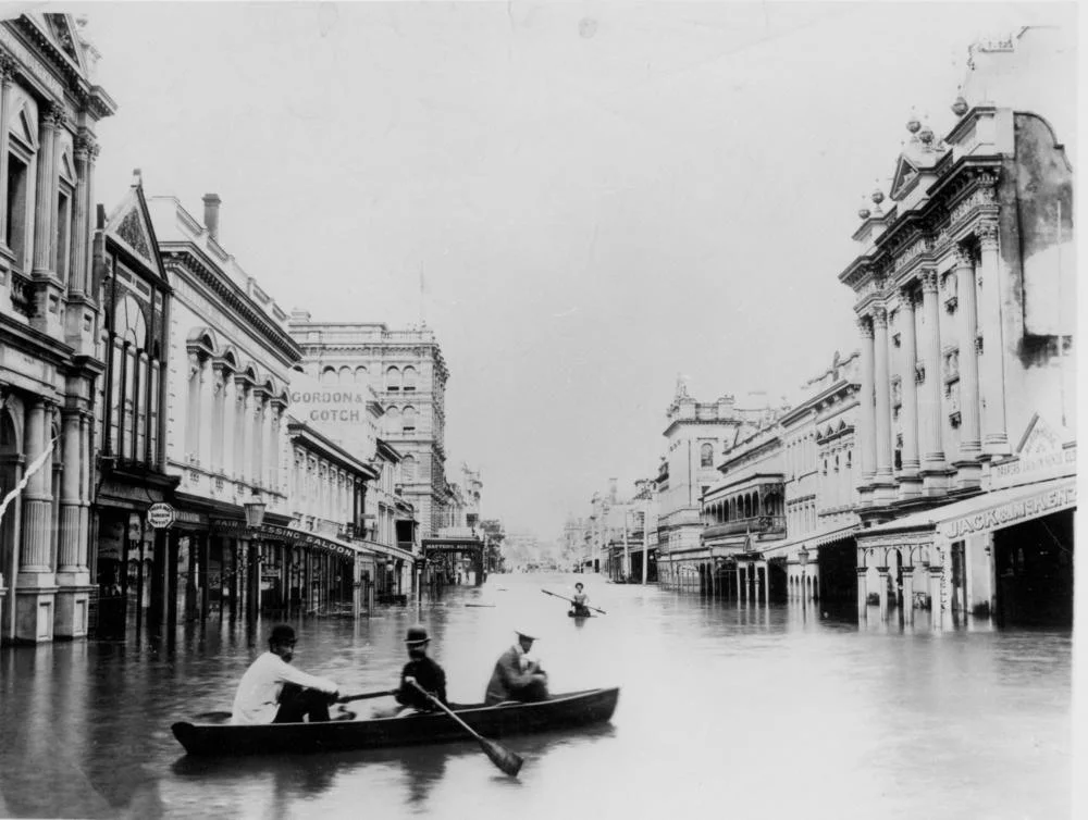
The 1893 floods exposed the limits of that infrastructure
The floods remembered under the date 1893 were a sequence of events. Bureau of Meteorology records describe repeated rises during February, with another flood in June. Houses were carried away, communications failed and parts of the Victoria Bridge were destroyed. The Indooroopilly railway bridge also suffered catastrophic damage. Treating the year as one dramatic photograph misses the repeated disruption experienced by residents.
The failure of a bridge creates consequences beyond the structure itself. Goods and people still need to move, but their familiar crossing has gone. A flooded business faces the loss of stock and the interruption of customers at the same time. These overlapping effects explain why flood history belongs in an account of how a city works, rather than being reserved for a separate catalogue of disasters.
Historic photographs are useful because they reveal the relationship between water and ordinary streets. Recognisable shopfronts or street names turn a distant event into a question about a particular place. Use the photograph's own date and location carefully. An image of one part of Brisbane cannot show the depth or experience of flooding everywhere else in the city.
Flood memory continues to shape the modern city
Brisbane's later flood history includes major events in 1974, 2011 and 2022. The council provides historical mapping for those events and distinguishes river flooding from creek flooding, storm tides and overland flow. These are different mechanisms, so a single description of 'the river rising' cannot explain every affected street.
Flood protection also has limits. The Bureau of Meteorology describes the contribution of Somerset and Wivenhoe dams to reducing flood frequency in the lower catchment while noting that major flooding can still occur. That is a more useful statement than assuming that a large dam makes a city immune. The catchment extends far beyond the waterfront visible from the centre.
For a visitor, flood markers and interpretation add scale to an otherwise peaceful view. They should also prompt respect for current closures when conditions change. Historical information cannot establish whether a particular path is safe today. Check official warnings and local notices during severe weather, and treat a closed riverside section as a closure even if the water nearby appears calm.
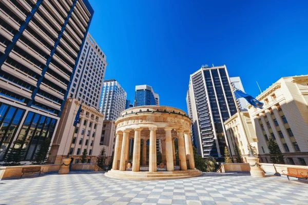
South Bank history before and after Expo 88
South Bank's current public spaces followed several earlier uses of the riverfront. The district had wharves, industry and places of entertainment before it became the site of World Expo 88. The exposition ran for six months, after which public debate helped shape what should happen to the land. South Bank Parklands opened in 1992.
The change was substantial, and it should not be described as though a park simply appeared on unused ground. Redevelopment replaces some activities while creating opportunities for others. Historical plans and photographs can reveal buildings and working spaces that a current visitor would otherwise have no reason to imagine. A successful public space can still have a complicated development history.
The present waterfront also invites a practical question: what allows people to stay? Places to sit, shaded edges and connections to the surrounding streets all affect whether a riverfront is used for a few photographs or for an entire afternoon. Watching those ordinary uses helps explain the social value of a park more clearly than a list of its most recognisable attractions.
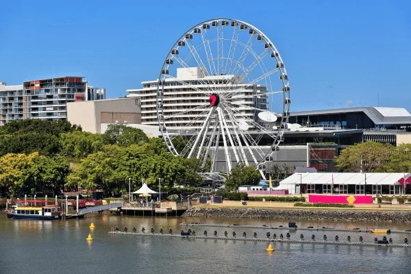
Read the river through what remains and what has changed
Brisbane's riverfront contains several histories at once. A surviving storehouse can retain the footprint of colonial administration. A converted warehouse can preserve the shell of a trading economy. A bridge can continue doing the work for which it was built while carrying far more traffic than its first users imagined. Their different fates help explain why the city does not look like a single planned composition.
The changes also raise useful questions about public memory. A prominent monument announces what an earlier generation chose to commemorate. A small plaque may record a flood that disrupted thousands of lives. An absence can matter too, though it needs evidence: an old map or photograph is more reliable than guessing what once stood on an open site.
Leave time to look across the water as well as along it. Distance can make the relationship between buildings, banks and bridges easier to see. For local historical context while you explore, use Trippy Tour Guide's paid Brisbane highlights walking tour. The river provides a way to connect those city stories to the wider movements of people and goods that helped shape them.
Frequently asked questions
Why was the colonial settlement moved to the Brisbane River?
The initial site at Redcliffe proved unsuitable. The settlement moved upriver in 1825, although the National Museum notes that the exact foundation date and reasons for selecting the final town site are not fully documented.
Was the 1893 Brisbane flood a single event?
No. The historical record describes several flood peaks during February and another flood in June. Damage included the loss of bridge structures and widespread disruption to homes and commerce.
When did South Bank become parkland?
South Bank Parklands opened in 1992 after World Expo 88 and decisions about the site's future. Its earlier history includes industrial and commercial uses along the river.
What should I look for along the waterfront?
Look for differences in building scale, surviving commercial structures and the ways bridges connect the banks. Historical images and interpretation help explain changes that cannot be read from the current view alone.
Can a self guided walking tour help explain Brisbane River history?
Audio stories can provide context for the buildings and river views you encounter. Look for the different work performed by a bridge, storehouse or converted warehouse, then compare it with present use. During severe weather, check current local notices before using riverside paths.